Centre France
![]() You can return to the map of European sites by clicking here, or select a site from the list in the left menu.
You can return to the map of European sites by clicking here, or select a site from the list in the left menu.
This zone extends from the Nièvre department (58) to extreme West of Saône-et-Loire (71) to Indre (36) in the West, through departement of Allier (03) and Cher (18). The Creuse department (23) holds only very occasionally a few wintering birds but includes an important staging area, the Etang des Landes, for Common Cranes during migration. Between the two major wintering sites in France, this « Central France » area is about 250 km southwest of Lac du Der (51-52) and 350 km northeast of Landes (40).
After a few wintering records during the 1970’s, Common Cranes increasingly used different sites from the early 1980’s and especially from the winter 1996-1997. Since 2009, more than 10 sites are used by cranes each winter, with a total population between 9500 and 16000 birds.
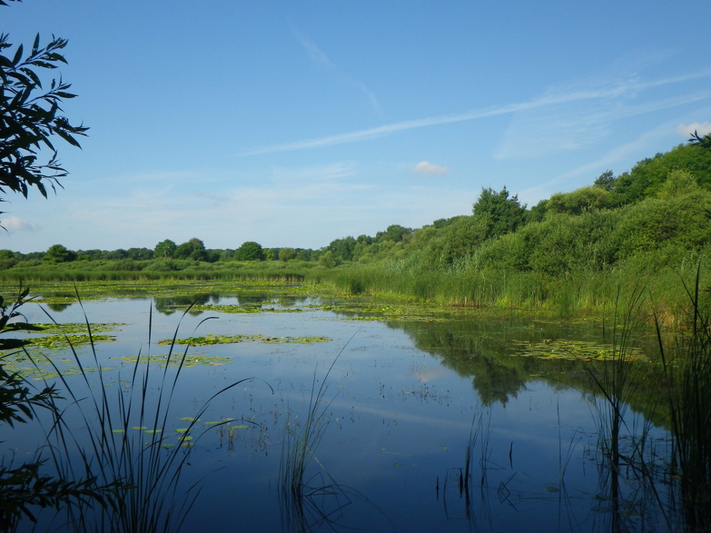
The wintering sites are of two types : classically one to several ponds in large cultivated areas (mostly maize), or more remarkably, a rarer habitat in Europe, cultivated areas associated with woodlands along the two « wild » rivers, Loire and Allier. These sites are sometimes small and highly sensitive to human disturbance.
Therefore it is imperative to watch cranes only from roads to limit this disturbance, and never try to approach the roosts. Moreover, the cranes are on private properties which must be respected. Farmers tolerate the cranes in spite of the damage they may do to crops. So, one must not add the harm of walking through fields, to get close to cranes or to photograph them, as some too often happen to do. Be strictly respectful of these constraints to maintain the wintering sites in this region.
The wintering sites and major staging areas are followed by the members, volunteers and professionals, of several local associations :
In l’Allier, par Guillaume Leroux, Jean-Christophe Sautour, Sylvain Vrignaud , ...
In Cher, par Yves Bolnot, Sébastien Brunet, Jean-Michel Chartendrault, Stéphane Coquery, Stéphane Lebreton, Sébastien Merle, Brigitte & Didier Migneau, Faustin Moreau, Annie & Alain Ouzet, Jean-François Ozbolt, Johann Pitois, Françoise et Michel Roger, ...
In Creuse, by the staff of the Natural Reserve de l’Etang des Landes
Information : Sébastien Merle
Etang de Cousseau
The Nature Reserve of étang de Cousseau
The national nature reserve of étang de Cousseau was created in 1976. It is located 50 km west of Bordeaux and 3 km east of the Atlantic coast, in the Bay of Biscay.
The SEPANSO is the NGO in charge of managing of this remarkable wetland.
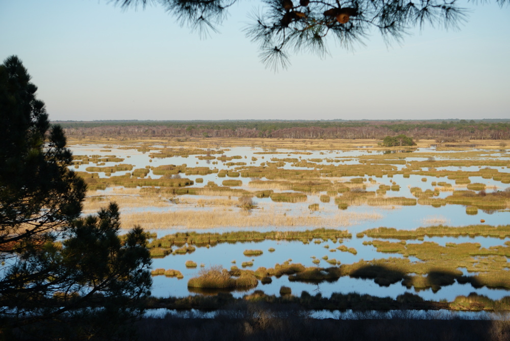
Spreading over 882 ha, the reserve is composed of 4 main habitats. A 50 ha freshwater lake is locked between 300 ha of forested primary sand dunes on the west side and 444 ha of peaty marsh (reed, willow, great fen-sedge, bucktooth) plus 88 ha of sandy heathland (purple moor-grass) on the east side.
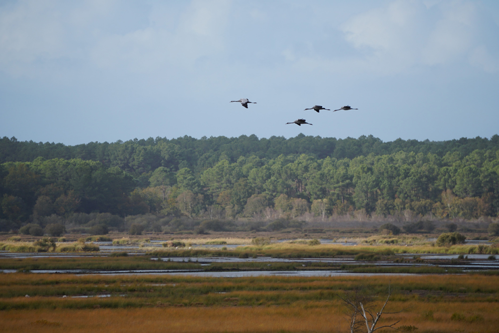
Land management
The marsh is managed by a herd of marine landaise cattle, a local rustic breed, in combination with mechanical mulching to keep the habitat open. Water levels are managed using a network of artificial channels and water locks. They are kept optimal year round for water birds, especially waders.
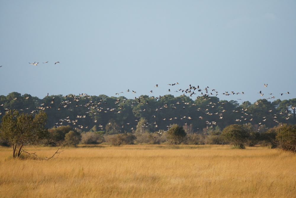
These conditions are perfect for the overwintering of thousands of common cranes that spend the day feeding in surrounding maize fields.
Monitoring
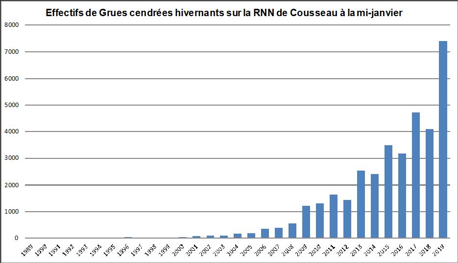
The overwintering of common cranes at this site began with just seven individuals in 1988. By 2000, 40 individuals were observed. Numbers continued to rise, reaching 1,000 individuals by 2009. Recently, population growth has become exponential, from 2,516 individuals in 2013 to 7,000 common cranes in January 2019. Today, the nature reserve is one of the most important wintering site in Gironde.
Grus Gascogna
The Reserve is also part of the regional network « Grus gascogna ». This project aims to develop knowledge, conservation and education around the common crane in the region of Landes de Gascogne.
Visit the site
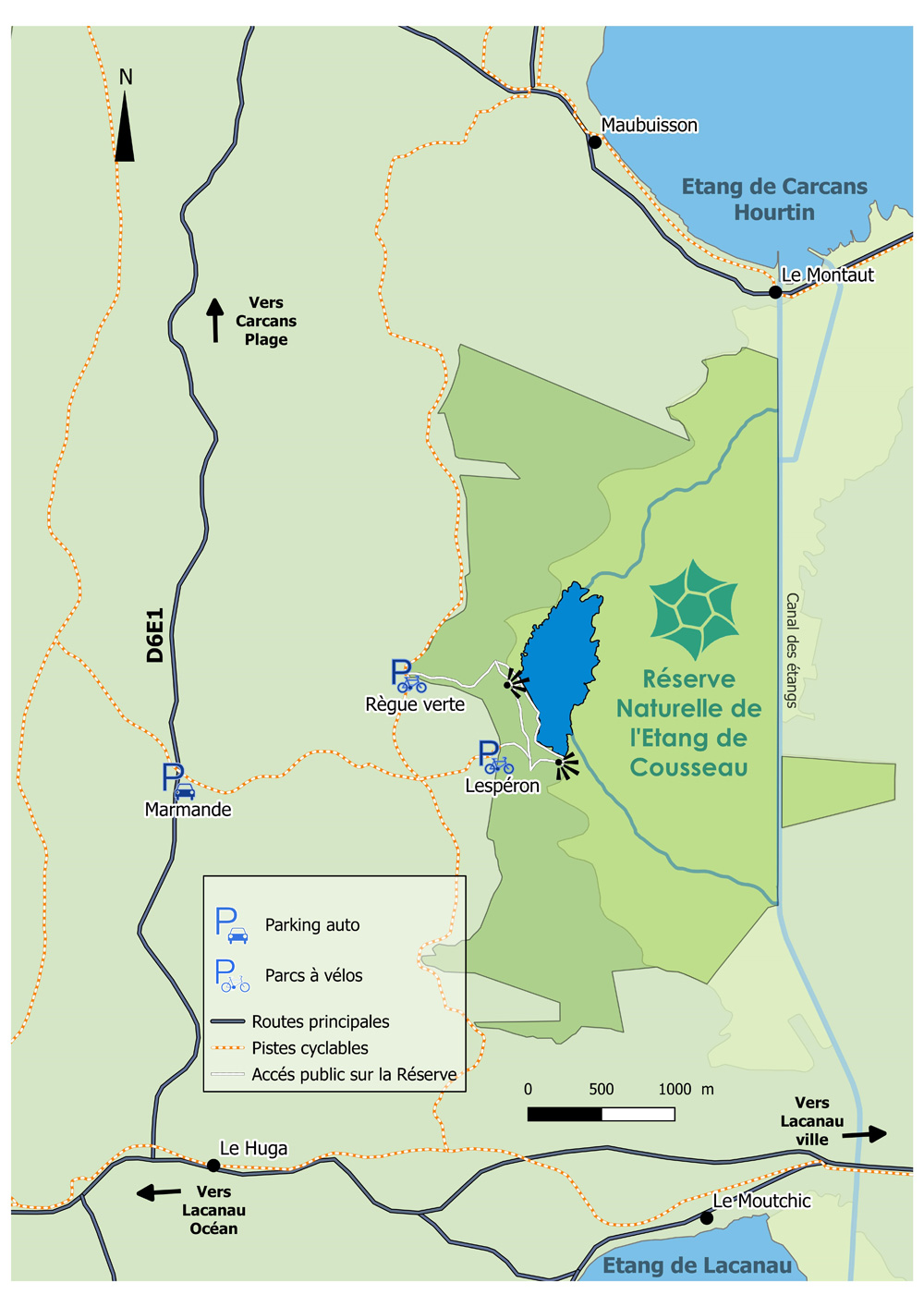
From mid-October to mid-February, common cranes can be observed from one of the three obseration points (including two 12 metre and 20 metre high towers). The show usually begins in the middle of the afternoon and continues untill sunset, when you can watch the common cranes return in huge groups from their feeding grounds to spend the night in the marsh.
Get there
A public path is open year-round on the reserve, from sunrise to sunset. Bicycles and dogs without a leash are forbidden.
Lachaussée
In order to ensure the long-term preservation of the Lachaussée ponds site, a remarkable natural and historical heritage, the Grand Est region has classified this territory as a Regional Nature Reserve (R.N.R.). With a total area of 607 ha, the R.N.R. de Lachaussée is the largest of the six reserves classified to date in Lorraine. Located at the eastern end of the Meuse department, and more particularly in the "Petite Woëvre" region, its perimeter is divided into the municipalities of Lachaussée and Vigneulles-Lès-Hattonchâtel. The entire site is located within the Lorraine Regional Natural Park.
Long known for its great biological interest, the site benefits from multiple statutes and inventories ensuring its protection. Its registration in 1991 under the RAMSAR convention is a strong example.
The Lachaussée pond and its network of peripheral ponds, filled in at the end of the 13th century, constitute the heart of this nature reserve. With more than 300ha of wetlands, they indeed offer a diversity of exceptional natural habitats which give them a major role in the conservation of many protected animal and plant species.
The site serves in particular as a dormitory for thousands of migrating Common Cranes.
Lacs Aubois
 Introduction.
The site of the lakes in the Aube department is comprised of three lakes : the Amance lake, the Temple lake and the Orient lake. Together, their surface is approximately 5,000 hectares. Surrounded by forests, those lakes have been created in 1966 for the latter and during the 1990s for the two others. Their main purpose is to regulate the flow of the Aube and Seine rivers in order to prevent devastating floods in the Paris region. In summer, the lakes are used as suppliers of water, enabling a better navigability for both rivers and improving groundwater recharge.
A very important axis for the waterbirds.
The three lakes are located just on a migration corridor which crosses the damp region of Champagne, a very important axis particularly for the waterbirds. Consequently, they represent first rate stopover or wintering sites for many species between the nesting sites in northern Europe and the wintering areas located in Spain and Africa.
Due to their rôle, the lakes in the Aube department are subject to a specific hydraulic regime. There is an annual « tide » (in fact a massive drop in the water levels), the water receding between July and November and coming back between December and June. Wide mudflats appear by the end of summer, when the first migratory birds, such as shorebirds, arrive.
The lakes and the Common Crane.
The Common crane is seen on the lakes, particularly the Temple lake, where the species form roost sites. Their numbers are far less than those present on the Der lake, located approximately 40 kilometers northeastward. Each year, thousands of cranes make a stopover at the lakes in the Aube department, the record being on 11 Novembre 2014 with 21,000 birds counted that day.
Furthermore, a few thousand of them winter there.
La Laguna de La Janda
![]() La Janda The area known as La Janda is a huge agricultural area in southern Cádiz province that was once one of the biggest lakes and wetlands in Europe with a surface area of 3,700 hectares. The Common Crane used to breed on the lagoon until 1954.
La Janda The area known as La Janda is a huge agricultural area in southern Cádiz province that was once one of the biggest lakes and wetlands in Europe with a surface area of 3,700 hectares. The Common Crane used to breed on the lagoon until 1954.
Unfortunately a process of drainage was started in the middle of the 19th century and completed in the late 1960s, destroying this wetland paradise that was once on a par with Doñana in terms of ecological importance.
Today it is an agricultural land that still retains important natural values that are enhanced when unusually heavy winter rains temporarily flood the basin.
La Janda retains natural vegetation along the drainage canals and, because of its geographical location, attracts thousands of birds migrating across the Strait. There are several habitat types, huge prairie type arable fields, sparse cork oak woodland, reed lined drainage ditches and some traditional flower meadow and pasture.
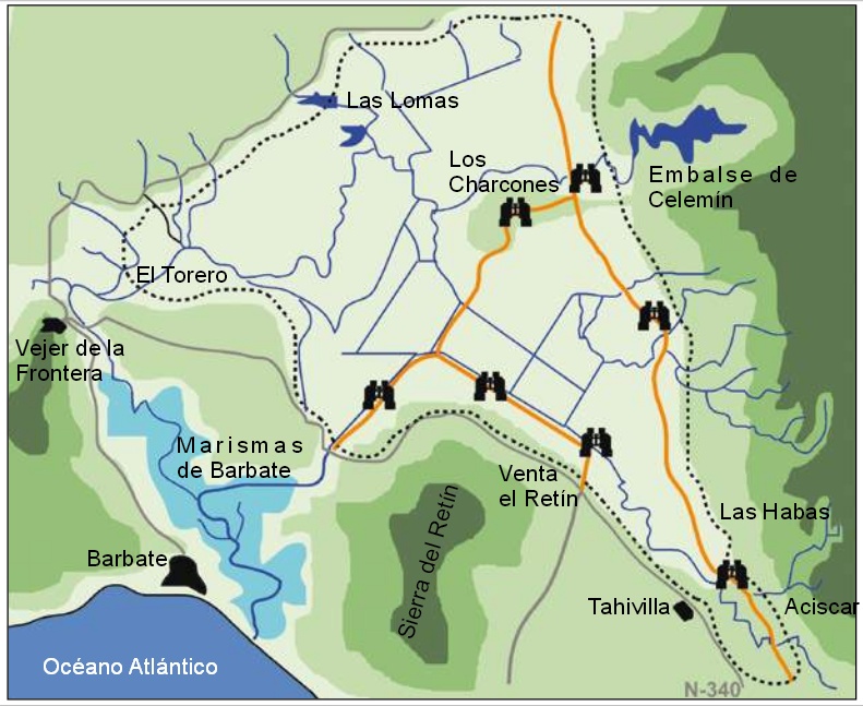 Currently, La Janda and the surrounding areas are very heterogeneous with regards to vegetation, including one of the few wild olive dehesas of the Iberian Peninsula, and pasture and cultivations that include an interesting community of grassland species, such as Common Crane, Collared Pratincole, Black-winged Kite and Montagu’s Harrier. Moreover, it is the only place where the Great Bustard may be seen in the whole area of the Strait.
We must also mention the important role played by the many drainage channels for aquatic species, as they provide marshland vegetation on their banks; and also the recent creation of rice paddies that have provided another habitat for those species.
Information : Arkadiusz Broniarek-Zięba
Kristianstads Vattenrike
The Pulken visitor site in Kristianstads Vattenrike is a popular crane watching destination. In spring migrating cranes are fed here to prevent damage to newly planted crops. From the birdwatching tower visitors from near and far can enjoy the cranes’ courtship dance. The large number of cranes come in late March and early April depending on the weather.
Feeding cranes at Pulken reduces damage caused to farmland and allows people to watch the cranes dancing at close quarters. Cranes particularly like newly sown corn and wheat. This can result in substantial damage to spring crops.
.jpg)
The Biosphere Office has been working with farmers, the Bird Society of North-East Scania and the County Administrative Board to reduce the damage since 1997. The Crane Group feed the cranes with corn in a separate field at Pulken Outdoor Museum in cases where the arrival of the birds coincides with spring planting undertaken by farmers.
This minimises the damage caused to newly planted arable fields and allows the cranes to feed undisturbed.
.jpg)
The cranes are a great attraction to everyone interested in birds, who can enjoy the cranes from the outdoor museum. Tourists and birdwatchers have helped provide a source of revenue for the tourism industry. The birdwatching tower at Pulken Outdoor Museum has been adapted for wheelchair users, and in 2014, the Biosphere Office created a new exhibition on the cranes and the history of the site.
.jpg)
Kristianstads Vattenrike covers an area some 35 x 35 km in size that includes a variety of natural environments. The River Helge å flows through the landscape into the Baltic Sea, though wetlands and seasonally flooded grasslands, past leafy forests and sandy arable land. These diverse natural habitats are home to a wide range of animals and plants.
In 2005 Kristianstads Vattenrike was awarded biosphere reserve status. Since then it has served as a model for sustainable development under the motto “Benefiting nature and people”. There are some 600 biosphere reserves worldwide. Kristianstads Vattenrike is the oldest of the five biosphere reserves in Sweden.
Kristianstads Vattenrike is an ideal place to observe birds all year round.
.jpg)
As the cranes fly north, ducks and waders take over the seasonally inundated grasslands around Pulken. White-tailed eagles can often be seen around the River Helge å in winter. There are lots of birdwatching towers dotted around Kristianstads Vattenrike. Our top tips include sites such as the Linnérundan Trail, Håslövs ängar, Hercules and Äspet.
![]()
The National Nature Reserve «Michel Brosselin» from Saint Denis du Payré
Created in 1976, the National Nature Reserve "Michel Brosselin", located in the heart of the Marais poitevin, protects 207 hectares of natural wet meadows. The alternation of "drops" (moist depressions) and "beautiful" (drier high parts) form a microrelief favourable to biodiversity and 272 species of birds have already been observed there.
The first known observation of Common Crane dates back to 1974 and since winter 2006-2007, a roosting place appeared on the nature reserve. Birds also use the other roosting place already known, the saline meadows in the Nature Reserve of the Bay of Aiguillon.
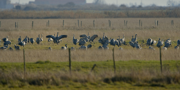
Once rare in Vendee, this species is now become a regular host, even if this department is located far away from its usual migration corridor. This is due to the exceptional crossing of cranes in the autumn 1982, during which several thousands of birds had been deported by violent winds from South-East, that the wintering is gradually set up in the sector.
The presence of large feeding areas of also (cultures of the polders and marsh meadows) and the necessary quietude for the roost, offered by the two natural reserves, allow the cranes to find there ideal wintering conditions. Currently, several hundreds of birds regularly make a halt in South-Vendee between November and March. This number, if it remains modest, is nonetheless a bit amazing for the french West-Central Atlantic.
For the peace of the cranes and the rest of the avifauna, access to the Nature Reserve of Saint-Denis-du-Payre is regulated and prohibited outside opening periods. Discovery events are nevertheless possible on reservation. Information on these animations on the website of the reserve.
Information : Katia RAIMBAULT (National Nature Reserve « Michel Brosselin »)
Translation: Sylvie Gendeau
Informations about migration sites and Common cranes
On many sites, the ornithologists study (counting, bird banding ...) common cranes.
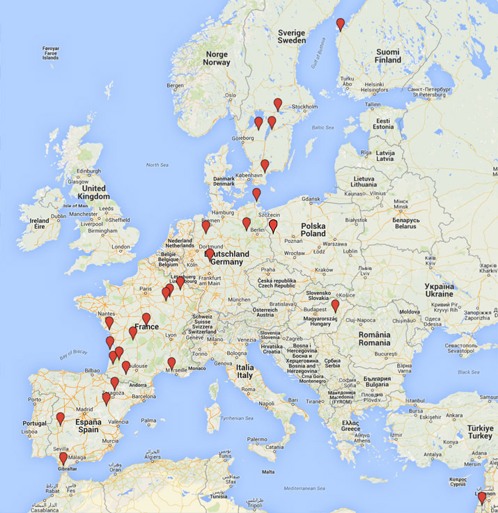
The map shows the most important of them.
Click on the map or use the menu on the left to learn more.
